Nova Scotia - part 2
(sightseeing)
July 11, 2018 - July 13, 2018
Drove from Shubenacadie to Grand Pre' through the countryside. The roads in Nova Scotia leave a lot to be desired. The winters are tough on the roads here and we were told Nova Scotia is a poor province so they don't have lots of money for road repair.
Blue Beach Fossil Museum near Hantsport
Laura discovered there were fossil sites around Nova Scotia from someone while doing the laundry one day. She googled it and found Blue Beach Fossil Museum in Hantsport, very near to our next destination. We decided to check it our en-route - meaning we took the motorhome/car combination directly to the site! At the end of a short dirt road we found a very small parking lot! That necessitated unhooking the car, then maneuvering the motorhome around until it was out of the way of the other cars parked there. This small parking lot serves both the fossil museum and access to the beach where the fossils are located.
We walked down a short driveway and met Chris Mansky and his wife Sonja who are the owners of this amazing little museum. They are both self taught paleontologists and they have thousands of fossils from the area stored in their building. Chris showed us around and described some of the items.
 |
| If I recall correctly, this is the pattern left by the bark of a tree. |
 |
| Raindrops left in mud. You have to reverse your thinking on this one. This is the silt layer that filled in over the mud then hardened. |
 |
| Paw print. Same idea as the picture above. The silt filled in the paw print then hardened. |
 |
| Actual raindrop impressions. Notice the general wavy pattern of the entire piece. |
 |
| The remnants of the stalk of a horsetail plant. |
 |
| Blue beach where the fossils have been found. It's off the Bay of Fundy so the tide is always uncovering new items. It also affects when you can get to the beach to search. |
Wolfville
Wolfwille is a wonderful little town near Grand Pre' (pronounced Pray). It is home to the world's smallest harbor. We were standing on the dock about half way between low and high tide and found it hard to believe ships could even get into this harbor.
 |
| Looking down from the dock at the mud that makes so much of the tidal areas a light chocolate color. |
 |
| Looking out from the dock towards the Bay of Fundy at half way between low and high tide. The point you see in the middle of the picture is part of Cape Split. |
 |
| Same picture as above - at high tide. |
Grand Pre'
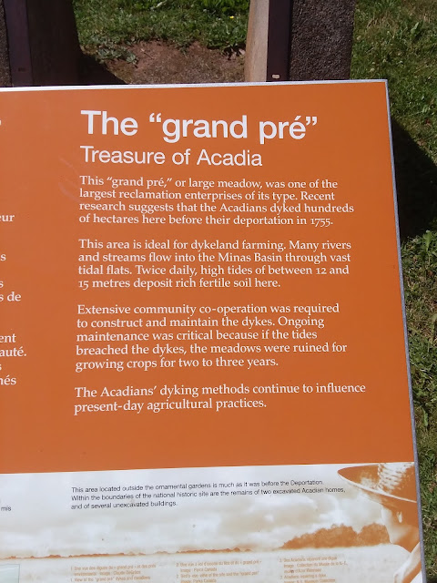
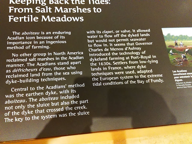
Two dykes were built between the mainland and a narrow but long island off the coast, one dyke at each end of the island. The result was a large area of farm-able land once the salt content was lowered by rainfall. The picture below (from a brochure) shows it best.
 |
| The grand pre' (large meadow) that resulted from the dykes established by the Acadians. The original island to which they connected one end of each dyke is in the far distance. |
 |
| Cross section of a dyke showing the sluice and clapper valve. |
The original European settlers who came to this area in the 1630's were Roman Catholics from France. They called the area Acadie and they became known as Acadians. The pictures below tell the tragic story of their life in what is now the maritime provinces.
 |
| 1755 Embarkation With only the possessions they could carry, the Acadians were ordered to abandon their homes for the ships that would take them into exile. |
Grand Pre' National Historic Site is a monument to the all the Acadian people who initially settled the maritime provinces. The centerpiece of the site is the church.
 |
| The guides at the historic site dress in period clothing. Notice the wooden shoes. We thought wooden shoes were specific to the Netherlands but it turns out they were used in France as well. |
 |
| The grounds of the monument are beautifully maintained and make for pleasant walking. |
 |
| Laura standing next to one of the enormous weeping willows standing on the historic site. |
 |
| The beach at the tip of Grand Pre' at low tide. |
 |
| Same beach at high tide. |


