Eastern Colorado, Kansas, Missouri
(Sightseeing and some genealogy research in Kansas)
June 20, 2017 - July 1, 2017
We pretty much booked it through eastern Colorado and western Kansas. We've been on the road for 16 months now and we haven't even reached the Mississippi River! Of course we've had any number of delays but it's all good. Here are a couple of things we saw as we drove along.
 |
| Rafting on the Arkansas River |
 |
| Yee hah! |
 |
| Arms for wind machines. |
 |
| The power generating portion of wind machines. |
 |
| The nose cap for wind machines. |
Laura's had some genealogical research to do in Kansas so we found a place in McPherson then she trekked over to Hillsboro and to Newton where there are two different Mennonite Archives. Because we happened to get there near the weekend we ended up staying for 5 days in order to her to get what she needed. She was finally successful in determining which Mennonite church her family attended. That should help with future research.
From McPherson we headed toward Missouri where we stopped in the town of Nevada for the night. It didn't take us long to figure out we were in a very different place than Washington State.
 |
| Regardless of the signs, the campground was very nice and the folks very friendly. |
From Nevada we drove to Lake of the Ozarks where we stopped to see Bridal Falls Cave. We've always enjoyed seeing caves and this was a particularly beautiful one.
 |
| Lake of the Ozarks |
 |
Virtually every property along the lake must have a dock with a boat.
The lake would be a wonderful place to spend time cruising around. |
 |
| Stalactites in Bridal Cave |
 |
| a sort of waterfall of stalactites |
 |
| Looking up at an especially high portion of the cave. |
 |
| Straw formations |
 |
| Stalagmites |
 |
One of several pools in the cave.
This was the end of the line for visitors but the guide told us the cave
continues for quite a long distance. To continue you have to climb down and cross this pool. |
After seeing the cave we kept on driving, and driving and driving since we couldn't find a campground along our route. We finally ended up in Villa Ridge, not too far out of St. Louis where we found a lovely campground with it's own pond. This particular campground also has a paint ball range which is quite popular, as you might imagine.
 |
| Canada geese |
 |
| What a nice place! Too bad we were only staying for one night. |
The next day we drove over toward St. Louis, bypassing the downtown area and finally crossing the Mississippi into Illinois.
 |
| Crossing the Mighty Muddy Mississippi |
We found a nice campground in a town called Cahokia where we stayed long enough to visit Gateway Arch in St. Louis and the Cahokia Mounds in Collinsville, Illinois.
 |
| Back over the Mississippi to visit "the arch." |
 |
I was very surprised to find that the arch is triangular in shape!
Who knew? |
 |
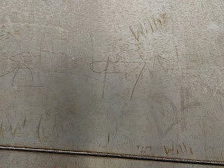
| Why is it that people feel the need to mark everything up? |
 |
| The arch from it's near it's base. |
 |
| Look closely and you can see the windows in the viewing area at the top. |
 |
This is the loading area for the tram that takes you to the top.
The tram consists of 8 small quonset hut shape cars with 5 seats in each car.
There are normally two trams going up and down. One from each leg of the arch. |
 |
| 2 of the 5 seats in the "capsule". |
 |
| Hurry up dad before they close the doors. |
 |
| The viewing area at the top. It's not a very large area. |
 |
You have to lean across the carpeted area to see out the windows. They are
slanted down because of the triangle shape of the structure. |
 |
View to the east across the Mississippi. Unfortunately it was a cloudy when we were up there.
When we finally got back out side it was lovely and sunny! Go figure. |
 |
| Panoramic of St. Louis to the west. |
 |
Waiting to catch the tram to descend to the bottom. It's quite a mess when the doors
open and the people coming up get out while the people going down try to stay out of the way. |
 |
Before we left we watched a movie showing how the arch was built. It was very interesting.
This picture (taken inside the movie theater) shows the last piece being put into place at the very center. |
The next day we explored the Cahokia Mounds which are the remains of what is today called the Mississippian culture. It's the largest city of it's kind north of Mexico. It's so called "golden age" was from 1100-1200 AD and it was larger than London in 1250.
 |
This picture shows the relative size of the protected area where the mounds were found.
There's actually more area than the picture shows - a total of 2,200 acres but this is where
most of the mounds were located. Hardly any of them have been archaeologically examined.
The big mound in the center is Monk's mound - built over several hundred years - one basket full
of earth at a time. |
 |
Example of a stockade that went around a large portion of the area, including Monk's mound.
Archaeologists believe the upper class people lived inside the stockade and everyone else lived outside it. |
 |
| This is a round topped mound and excavations indicate these are burial mounds. |
 |
| This is a flat topped mound which was used to elevate the houses of the most important people. |
 |
| Monks Mound. This mound has three levels. The chief lived on top of this mound which elevated him above all others. |
The history of the mounds and the people who built them are really quite interesting and the area is a wonderful place to walk. Dogs are allowed but we didn't find that out until we got there so poor Barney got left at home. He would have loved walking here.
In addition to the beautiful grounds there is a great museum with some fantastic artifacts. For some reason we didn't realize the museum was there until quite late in the day so we had to hurry through it which is unfortunate because it really is well done.


